Skip to content
YouTube
LinkedIn
sUAS News
Home
CubePilot
FPV Wiki
Drone Directory
Delivery Drones
Ukraine
DJI
Jobs
Blue sUAS
Altitude Angel
Home
The Market
GIS
Page 34
Category:
GIS
Drone Mapping in Zanzibar
Luke Wijnberg
LizardTech White Paper Reveals 12 Hidden Gems in GeoExpress Software
Gary Mortimer
Loxley Chooses SimActive for Royal Thai Government Project
Press
DroneDeploy Opens the Skies to Free Autonomous Aerial Mapping
Press
3D Measurement Without Software
Press
UAV Operators Harness The Power Of 3D Visualization and Measurement With 4DMapper
Press
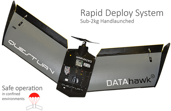
QuestUAV DATAhawk
Gary Mortimer
Sentera Launches OnTop™ Platform for iOS Operating Systems
Press
4DMapper releases Asset Inspection data support
Press
Autonomous drone navigation and “SLAM”, geospatial data processing
Press
Posts pagination
Prev
1
…
32
33
34
35
36
…
59
Next