Reflectance Maps, the Building Block of Precision Agriculture

Last weekend I found myself pounding nails into the wall with a rock I found in my yard. With hammer missing and pictures needing to be hung, I had to make due. Fine, the nails were a bit bent, the wall marked, but it got the job done. I’d never dream, however, of using a rock for serious hammering work.
The use of index maps in precision ag is similar, but not as simple as rock vs. hammer. Index maps are generated using either orthomosaics or reflectance maps, with orthomosaics being the rock and reflectance maps being the hammer. Both tools get the job done, but only one should be used. In the world of precision ag and mapmaking, by trying to simplify all index maps, I think we’re missing key details.
“Orthomosaics are optimised for aesthetics to tell you where, while reflectance maps focus on radiometry to tell you how much.”
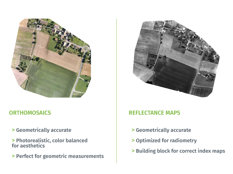
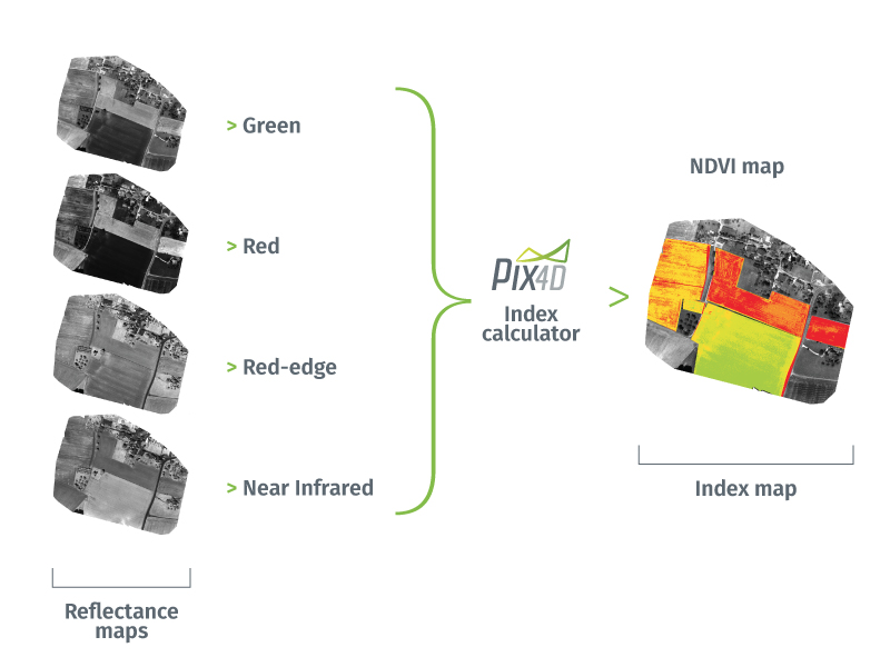
Reflectance maps hold key radiometric information which is combined to generate the index maps (illustration below) that have become a universal growers’ tool for more efficient, less diseased, and better yielding crops. The information reflectance maps provide is something orthomosaics can’t capture or exploit to full potential.
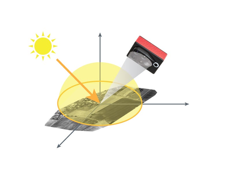
When making decisions based on an index map or deciding how much of a certain chemical to apply to your field, you need to be able to trust your map’s values. Pix4D software is one of the few to produce reflectance maps, and to do so takes a number of parameters into account, ranging from camera specific (gain, sensor characterization, irradiance level, etc), to photogrammetrically derived parameters (camera and irradiance sensor pose, scene geometry, etc).
All this information is used to come up with a good estimate of what we call the Hemispherical Conical Reflectance Factor (HCRF), a model we use to describe reflectance. Once the HCRF has been estimated, Pix4D blends different observations, giving more weight to nadir images.
Next time you receive your NDVI map (or any other index map), ask yourself, “was it generated with an orthomosaic, or a reflectance map?” Can you trust your index map and confidently use it to prepare a prescription map? In the end,
Using an orthomosaic to generate an index map is like hammering a nail with a rock; it may do the job, but is definitely not the tool to rely on for a nail hammering business.
For more information on Pix4Dag, click HERE


